- Normal levels of field noise are higher at depth due to the larger electrode spacings needed to measure this portion of the potential field. You can use EarthImager to view received voltages, repeat error, reciprocal error and model misfit error in these deeper cells. Lowering contact resistance will improve your signals levels. The AGI SuperSting WiFi and associated accessories are optimized to accurately measure very low signals as found in long lines with dipole-dipole surveys. Using a merged array reduces noise and improves resolution while better assuring that you sample the full potential field. More details HERE
- Solving a smaller size model from a larger data set will improve the resolution of the targets within this smaller model domain. Make sure to show the full domain of your model as well.
- Always use the histogram data removal tool to solve these models as shown HERE
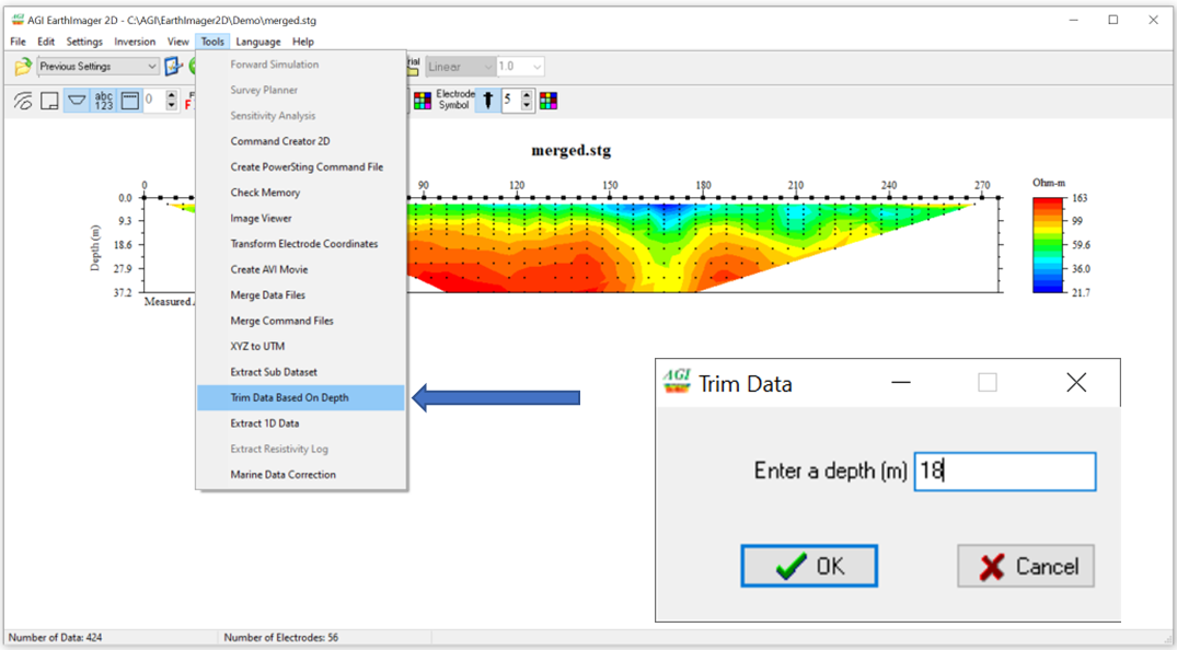
- Trim Data Based on Depth:
- Load a raw data file using EarthImager 2D > File> Read Data or use the Folder Icon in the toolbar.
- Select meters in your display from the toolbar icon that will show m, ft, #
- Choose Tools > Trim Data Based on Depth > enter max depth in meters and click OK to save a new STG file. Load and run this new data set using this method HERE